|
Yesterday, Friday July 21, 2006, was quite similar to Saturday the 15th. Easterly winds mixed through the boundary layer and southeast Arizona experienced another day of hot, dry, downslope winds. The winds at the surface became easterly at the TUS observation site around 10 am. Here at the house the winds were depressingly strong from the east after about 1 pm. The TUS observations, below, show that dewpoints plunged all the way into the upper 30s, a terrible state of affairs.
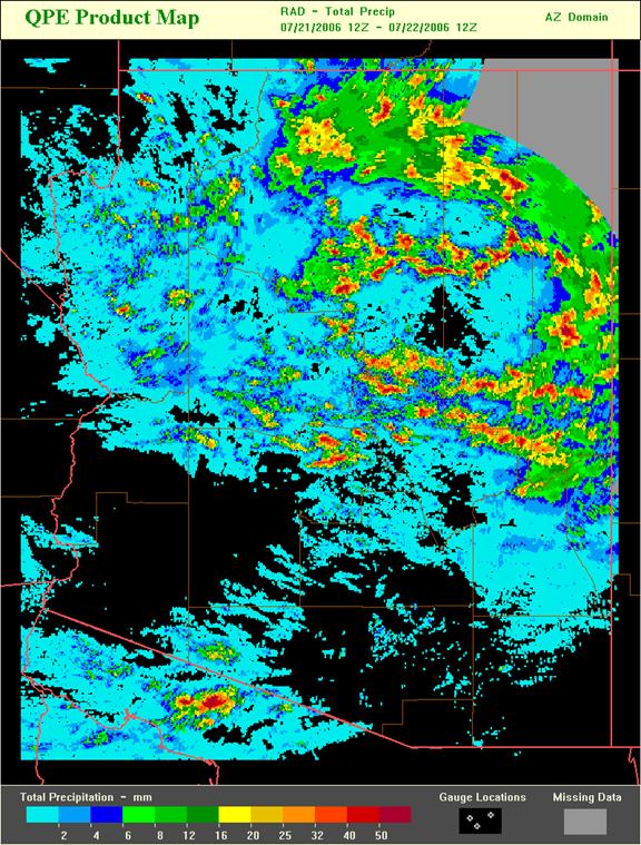
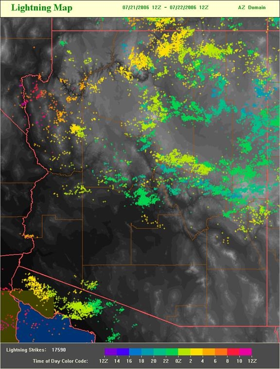
Conventional wisdom, as per several published papers, holds that drying and breaks in the monsoon usually occur when westerly flow intrudes from the east Pacific. However, distinct dryouts can actually occur here in the southwest with a variety of wind directions. The recent examples show serious drying coming in from the east. I have noted other cases when dry, low-level air advected into Arizona from the south, which is usually thought to be a moist, storm-supportive flow regime. So it goes. The 24 hour radar-estimated rainfall and a 24 hour plot of cloud-to-ground lightning locations are shown below. This current episode is even more suppressive in southeast Arizona than was that of the 15th.
The high-resolution WRF model forecast, run at the Dept. of Atmospheric Science at U of A, indicated that the easterlies would mix to the surface around noon; whereas, the NAM forecast indicated a region of convergence would be present over southeast Arizona at 5 pm. Finally, the TUS sounding taken this morning, release time 4 am about an hour before sunrise, is shown below. This is one of the most amazing morning soundings I've seen during my years in Arizona. There is only a tiny of nocturnal boundary layer present, with yesterday's afternoon boundary layer above and nearly unmodified during the night. The easterly flow regime is obvious. The TUS morning low was a chilly 89F and that may be the all time record highest minimum temperature observed at TUS.
|